 |
1975
UNIVERSITY OF ST ANDREWS GREENLAND EXPEDITION
|
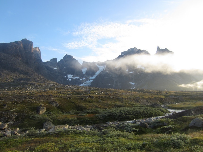
Climbing from Stordalens Havn in Cape Farewell Region
LATER VISITS TO STORDALENS HAVN
News - August 2015: Major fire reported in Itivdlerssuaq valley
after prolonged dry period. (Source: Sermitsiaq news service)
|
People who visited after 1975 To the best of my knowledge, none of the participants of the 1975 expedition ever returned to Stordalens Havn: which in a way may make sense. It is very difficult to repeat, or attempt to recapture, a unique summer, a unique experience and moment in time. However, it is interesting to learn of others who have visited in the intervening years. The valleys were in any case accessible to inuit hunting parties, a relatively short kayak's journey from Augpilagtoq - and we met a couple of such parties in 1975. Going back further in time, 600 years further back, the valleys were of course open to Viking settlement, and there are the remains of a Viking habitation at Stordalens Havn. It also seems likely that Bill Tilman harboured here in 'Sea Breeze' in 1970 before we ever visited. One thing to mention about harbouring at Stordalens: the harbour is shallow and there is a significant risk of getting grounded at low tide. That happened to our boat, which had to wait until high tide to right itself. Since 1975, there seem to have been many years... perhaps two decades... when no mountaineers ever visited. The rock climbing communities seem to have been drawn to Tasermiut, and it was not until 1996 that mountaineers returned again, to the mountains south of Stordalens - approaching from Narssap Sarqa. As far as I've been able to find out, when the Torssukatak cliffs and neighbouring Pamiagdluk climbs started to attract attention and visits, Stordalens was not used as a base. Parties tended to base themselves 2 km across the fjord on Pamiagdluk, or as I've mentioned up Narssap Sarqa, or in the valley south of Whaletop, or from Narsarmijit (Frederiksdal), or simply direct by boat. There's a hint that Cecilia Buil and Roberta Nunes may have used Stordalens in 2003, along with Pamiagdluk, when they made their new route 'Hidrofilia' up the Thumbnail cliffs in Torssukatak fjord. In 2006 the photographer Dirk Jenrich visited Stordalens Havn. In 2009 the Belgian Joery Truyen carried out an epic trek from Tasermiut and Taserssuaq lake, overland to Kangerdluk, then across to Stordalens Havn via the Ivssortussut valley, and then by the Itivdlerssuaq valley to Tasiussaq, and back to Tasersuaq. He has a great account, with loads of pictures on his website here (and see some of his photos below on this page). A year later Bob Shepton harboured there with 'Dodo's Delight' with the Favresse brothers, Sean Villanueva, and Ben Ditto in 2010, but only for a night before heading south to climb the Shepton Spire and Breakfast Spire, and one more night afterwards. Willem van Doorne passed through Stordalens in July 2013, on a trek across from Tasermiut, coming down close by High Rising, with astonishment at the views down Torssukatak fjord, before travelling from Stordalens up the 'big valley' of Itivdlerssuak to Tasiussaq. You can view some of his pictures lower down on this page if you scroll down - my thanks for permission to use them. In addition, in July 2013 seven Norwegian kayakers paddled from Herjolfnaes, via Torssukatak fjord to Stordalens Havn (where they camped, caught fish, and lit a driftwood fire) as part of a longer journey. Also in 2013, Tilmann Graner passed through Stordalens Havn with his wife Suzanne, on an epic trek from Herjolfnaes to Tasiussaq, then through the Itivdlerssuaq valley to Stordalens Havn (where they found 5 Icelandic ponies grazing!). They then crossed over to Kangerdluk, then again across to Quingeq Kujatdleq, up Quinguadalen to Kangikitsoq, and finally back to Tasermiut and Tiningnertoq. Tilmann has kindly let me reproduce photos from this journey (see below) but visit his site for more pictures. The following year, Frank Coen, Ruth Goris, Steven Lauwereins and Katleen Van Roy carried out a long hike between 11th and 27th August 2014 (see photos below, by kind permission), making similar crossings from Tasermiut and Quingadalen to the fjords of Kangerdluk and Kangikitsoq, and then hiked from Tasermiut to Tasiussaq lake, and through the Itivdlersuuaq valley to Stordalens Havn. There they met a German hiker who gave them a weather forecast for the next days, and although they were tempted to walk to the lookout point down Torssukatak fjord that Joery and Willem had photographed (see pictures below), they decided instead to return via Itivdlerssuaq in order to climb one of the western tops (1300m) of the Putorugtoq massif before the weather broke. They ascended it in very warm weather (their chocolate melted!) and that night the northern lights were in the sky. Other than that, the only definite and recorded base there was when Siebe Vanhee and Tim de Dobbeleer set up a basecamp there for a week in 2014, visiting the Thumbnail cliffs, and making a first ascent of Dreadlock Peak (see pictures below). There are some superb photos of the Stordalens and Tasermiut areas, taken in August 2017, by the Swiss photographer Urs Zihlmann. Some are posted below, with Urs' permission and you can see more of them here: https://urszihlmann.com/story/greenland Viktor Posnov visited Stordalens Havn in both 2018 and 2019, and some of his photos (links here and here) are posted lower down this page, including some screenshots from great drone footage, which is posted on YouTube and offers some really good angles. Views of the Stordalens area can be seen in this YouTube video at 0:01 to 0:23 and 1:04 to 1:12. More extended footage and shots of the Stordalens area (and also Pamiagdluk) can be seen in another YouTube video at 2:41 to 2:52, and at 5:09 to 5:40, and at 36:21 to 37:08, and at 37:28 to 37:44. Although most of the obvious 'first ascent' peaks were climbed in 1975 (and have not been reclimbed since except for 'The Ogre' aka 'Magic Mirror' in 1996 and 1997, and Agdlerussakasit in 1997), there are still many new rock routes available in the area (and of course, south around Whaletop / Pt 1303m from the fabulous valley there). In addition, by kayak from Stordalens, Pamiagdluk Island is there and waiting, with so many climbs to be done. The first ascents of many of the mountains in this area have been accomplished, but there are still vast possibilities for new rock routes, and a wide variety of new Alpine routes and ridges. PHOTOS BY DIRK JENRICH I know that the photographer Dirk Jenrich passed through Stordalens in 2006, but I have not been able to make contact, so click on the following links to see some of his photos: Stordalens Havn and another view here View to the north of Stordalens Havn Stordalens Havn at low tide, looking west, with the Itivdlerssuak valley heading up on the right Looking westwards up the Itivdlerssuak valley - the 1975 basecamp was sited just across the river in the foreground, a little way up from the seashore The Itivdlerssuak river (which could be 'interesting' to cross in spate) where it enters the sea at Stordalens Amitsuarssuk, with Tikaguta in the distance, rising above Narsap Sarqa: Pete Hunt and I visited on our 'Viking Feich Trip' at the end of the expedition - it was plagued by black fly! Another view here. And this view shows the basecamp site of the 1996, 1997 and 2008 expeditions to Narssap Sarqa, just below Tikaguta. View down Itivdlerssuak valley towards Stordalens Havn - and another view here Mountains south of Stordalens Havn valley Mountains south of Stordalens Havn, a couple of km up the Itivdlerssuak valley The Torssukatak sea cliffs, just round the corner from Stordalens Havn Dirk has a good collection of mountain photos from several locations in Greenland, including Tasermiut. PHOTOS BY WILLEM van DOORNE Willem spent 25 days hiking and pack-rafting in South Greenland in July 2013. His written account of an amazing long-distance journey on land and on sea begins here, but the section that brings him to Stordalens can be found here. He also shot a couple of videos. On the first video, you can see him walking up the Itivdlerssuak valley just above Stordalens Havn (at 2:35 to 2:38), paddling in view of the Torssukatak sea-cliffs (at 3:08 to 3:15), and viewed from a mountain to the north of Itivdlerssuaq near Tasiussaq, you can see the view westwards down Itivdlerssuaq towards Stordalens Havn (at 2:43 to 2:47 and 3:28 to 3:30), and the chain of mountains to the south of the valley, the highest one being Agdlerussakasit. In a second video there's a superb glimpse of the Torssukatak cliffs as he came over the hills to Stordalens (at 3:20 to 3:29) and more views of the same (at 3:45 to 4:09). In addition, click to view some great stills of the area, some of which with his kind permission I have posted below on this page if you scroll down: Phenomenal views of the Torssukatak sea cliffs from the summit of peak 680m (day 18) At peak 680m, Willem bivouaced, with another great view of the Torssukatak sea-cliffs, and high peak Agdlerussakasit, with the Itivdersusak valley to the right (Stordalens Havn where the river enters the sea). Another view up the Itivdlerssuak valley, from peak 680m, just before sunset. Alpenglow on the summits along Torssukatak early the next morning (day 19). The Torssukatak sea-cliffs seen while paddling to Stordalens Havn. Stordalens Havn, as Willem set off up the Itivdlerssuak valley. 1975 basecamp a little way off to the right of the picture, on the south side of the river. Bivouac in Itivdluarssuaq valley near a small pond on the south side of the Agdlerussakasit range (1763m) (day 19). Hiking through the Itivdlerssuaq valley (day 20). View up towards Lost Loch Camp and Matterhorn C, looking north from the Itivdlerssuaq valley. View back down the valley eastwards towards Stordalens Havn. Bivouac on the southern slopes of 1430m, with a massive view back eastwards through Itivdlerssuaq (day 20). On the summit of peak 1430m, with a great view back eastwards along Itivdlerssuaq valley (day 20).
PHOTOS BY SIEBE VANHEE Siebe Vanhee's climbing trip with Tim de Dobbeleer is reported upon in the Torssukatak section of this website. You can find the details here. He also has a detailed account on his own site which starts here, with some good climbing in the Tasermiut area here, and the section about Stordalens here. Some of the photos from that trip are posted below, with Siebe's permission.
|

Paddling between Augpilagtoq and Stordalens Havn (out of sight to right of distant iceberg) with Agdlerussakasit in centre (Photo courtesy of Siebe Vanhee)

The Thumbnail sea-cliffs on the west side of Torssukatak fjord (Photo courtesy of Siebe Vanhee)

On the Thumbnail sea-cliffs (Photo courtesy of Siebe Vanhee)

The only access to the Thumbnail sea-cliffs is by kayak (Photo courtesy of Siebe Vanhee)

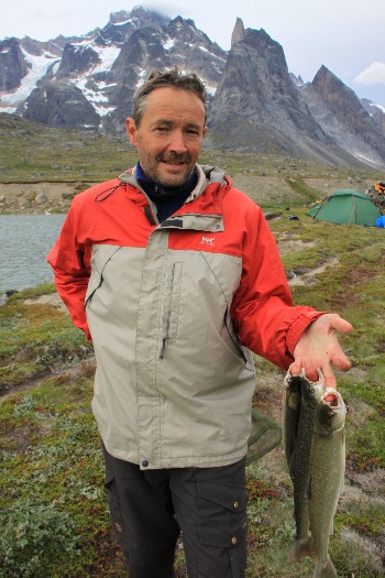
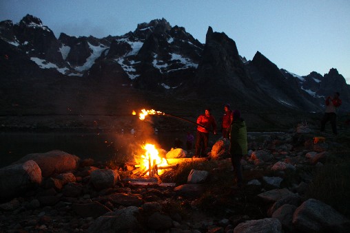
Fishing at Stordalens Havn (Photo courtesy of Siebe Vanhee)

Ten arctic char caught in an hour (Photo courtesy of Siebe Vanhee)

Wild mushrooms and arctic char, with some blueberry jam (Photo courtesy of Siebe Vanhee)

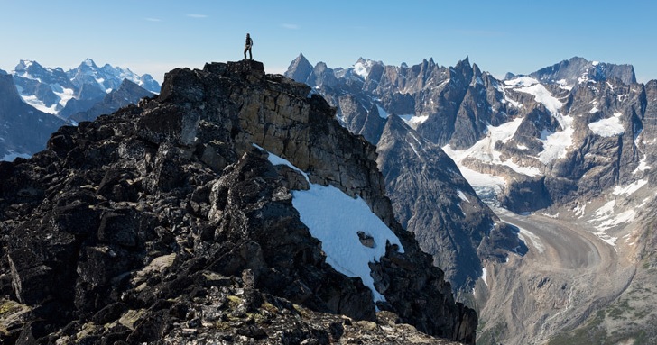
Approach to Dreadlock Peak, on the south side of Itivdlerssuak valley, a short hike up from Stordalens Havn basecamp (Photo courtesy of Siebe Vanhee)

The arrow gives a sense of scale, on this first ascent of Dreadlock Peak (Photo courtesy of Siebe Vanhee)

Climbing Dreadlock Peak (Photo courtesy of Siebe Vanhee)

Siebe on the summit of Dreadlock Peak, and the sacrificed dreadlocks - Stordalens Havn under his elbow (Photo courtesy of Siebe Vanhee)

Looking westward along Itivdlerssuaq valley, from the summit of Dreadlock Peak (Photo courtesy of Siebe Vanhee)

Siebe on the summit of Dreadlock Peak. The ridge to Inevitable and Crossoak Road are to the right. The High Rising / Mister Bruce mountains are in centre across the fjord.
The Itivdlerssuaq river feeds into Stordalens Havn near foot of picture (Photo courtesy of Siebe Vanhee)

Abseiling off Dreadlock Peak - the ridge to Inevitable is on the right (Photo courtesy of Siebe Vanhee)
|
PHOTOS BY URS ZIHLMANN In August 2017, Urs Zihlmann visited South Greenland, taking some wonderful photos around Stordalens Havn and Tasermiut, areas visited by the 1960, 1971 and 1975 St Andrews expeditions. Urs is a professional photographer and you can see his full account with many more photos here, as well as visiting his whole website here.
|

Ulamertorsuaq, rising above Tasermiut
(Photo courtesy of Urs Zihlmann)

Ulamertorsuaq, rising above Tasermiut
(Photo courtesy of Urs Zihlmann)

Ulamertorsuaq, rising above Tasermiut
(Photo courtesy of Urs Zihlmann)

Tasermiut Fjord after sunset
(Photo courtesy of Urs Zihlmann)

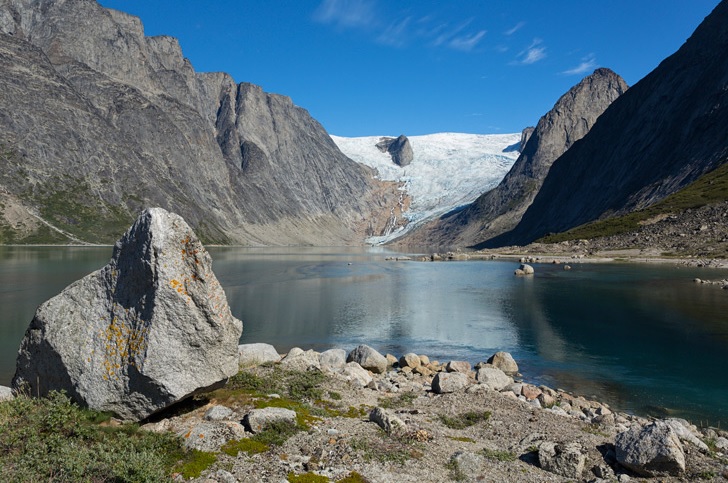
The Sermeq glacier used to reach down to Tasermiut, but has retreated in the years since the first St Andrews expedition
(Photo courtesy of Urs Zihlmann)

Overlooking Tasermiut Fjord
(Photo courtesy of Urs Zihlmann)

The start of the Itivdlerssuaq valley, which leads over to Stordalens Havn
(Photo courtesy of Urs Zihlmann)

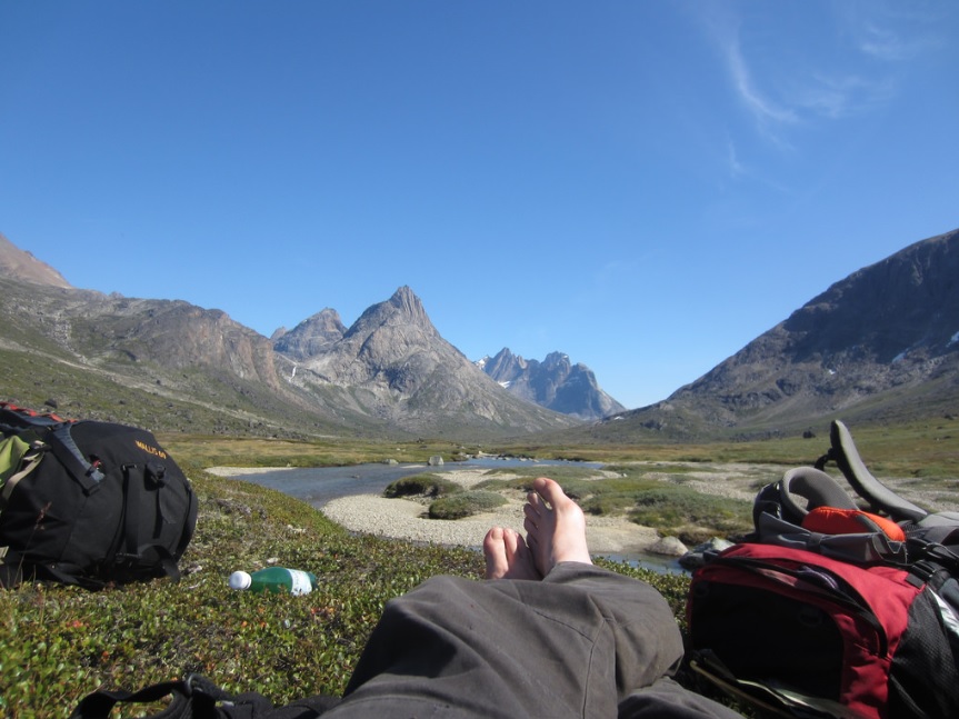
Tranquil spot near the top of the Itivdlerssuag valley, looking northwards up the valley towards 'Matterhorn C' and the Lost Loch camp that shelters beneath its steep face
(Photo courtesy of Urs Zihlmann)

A stunning view down Torssukatak Fjord with the dramatic sea cliffs: Stordalens Havn is out of view on the right
(Photo courtesy of Urs Zihlmann)

Another view down the Torssukatak Fjord
(Photo courtesy of Urs Zihlmann)

Sunset with Torssukatak Fjord on the left; and Stordalens Havn and Itivdlerssuaq valley on the right; the St Andrews 1975 basecamp was a quarter of a mile up the river; the highest peak is Agdlerussakasit, first ascended in 1975
(Photo courtesy of Urs Zihlmann)

Ice near Augpilaqtoq
(Photo courtesy of Urs Zihlmann)

The end of Kangikitsoq Fjord
(Photo courtesy of Urs Zihlmann)

The end of Kangikitsoq Fjord
(Photo courtesy of Urs Zihlmann)
|
PHOTOS BY JOERY TRUYEN In 2009, Joery Truyen from Belgium made a great trek, bivouacing under flysheet, from Tasermiut and Taserssuaq lake, across the mountains to Kangerdluk, then round the coast to Ivssortussat, and up the Ivssortussat valley, over and across the mountains to Stordalens Havn. From there he trekked up the Itivdlerssuaq valley to Tasiussaq, and then via Putorugtoq to the thick willow-scrubbed shoreline of Taserssuaq again. You can read about Joery's journey on his website here (for Tasermiut and Quinguadalen) and here (for the trek over to Ilua and Stordalens Havn). There are loads of fabulous photos and the website is well worth visiting if you are interested in these areas. Joery was fortunate with the weather, travelled light, and achieved a great route involving physical endurance. From Tasermiut he got great views of Ulamertorsuaq and Ketil from the summit of Suikkassuaq. More great views here of Ulamertorsuaq (from north-west ridge), and with Nulamertorsuaq here; and of Ketil from near the summit of Pyramiden, and its amazing north-west face. Joery also got a great shot of a Greenlandic white-tailed eagle. He explored many valleys including the Tiningnertoq valley and the beautiful Quinguadalen. Here is a moody and atmospheric view from quite far up Quinguadalen, looking back south-west to the Putorugtoq hills on a dark evening. Overgrowth and about the nearest thing Greenland gets to trees can be tiresome in lower Quinguadalen and along the shores of Taserssuaq. Joery came across viking ruins in Quinguadalen, abandoned probably 600 years ago. Halfway through his trip, he decided to head over to Kangerdluk, and from there to trek high overland via the Ivssortussut valley to Stordalens Havn and a round trip back to Tasermiut. He travelled relatively light with a flysheet bivouac, and was lucky with the weather. He did a detour to try to get overland to Augpilagtoq, but was confronted with challenging sea cliffs, and had a wild bivouac above some tricky sloping ledges. Returning to Stordalens Havn (some photos of this section, below) he trekked overland, through the 1975 expedition country, to the small settlement at Tasiussaq. From the hill above Tasiussaq, he got views back along Taserssuaq lake and the mountains beyond; and from Qaqatsiaq (500m) a great view of Tasermiut and Taserssuaq. A phone call to Niels in Nanortalik and he learnt there was a boat coming to Tasermiut, and soon he was on his way and leaving the 'Cape Farewell' country behind.
|

View from the mountains west of Augpilagtoq, looking across to the Torssukatak sea-cliffs (photo courtesy of Joery Truyen)
Bivouac on the mountain above Augpilagtoq, looking towards Torssukatak fjord (photo courtesy of Joery Truyen)

Magnificent view down Torssukatak fjord, with Maujit Qaqarssuasia and Agdlerussakasit (photo courtesy of Joery Truyen)

Another view down Torssukatak fjord, with the sun slanting down the Itivdlerssuaq valley beyond Stordalens Havn (photo courtesy of Joery Truyen)

Rounding the shore of Stordalens Havn before reaching the Itivdlerssuaq valley, which is behind camera to the left (photo courtesy of Joery Truyen)

Itivdlerssuaq col, looking up the northern valley towards the 1975 'Lost Loch Camp', and the obviously-shaped Matterhorn 'C' (photo courtesy of Joery Truyen)

Lake at the Itivdlerssuaq col looking eastwards down the valley, with the Agdlerussakasit massif behind (photo courtesy of Joery Truyen)

View across the Itivdlerssuaq valley, southwards - large bowled corrie to right of centre was the location of Sallies Kitchen Camp in 1975 (photo courtesy of Joery Truyen)

View looking eastwards up the Itivdlerssuaq valley which is the route over to Stordalens Havn from Tasiussaq (photo courtesy of Joery Truyen)
|
PHOTOS BY WILLEM van DOORNE Below are some great pictures from Willem's journey through 'Cape Farewell country'. You can visit his own web account here.
|

Willem looking down Torssukatak Fjord, with the stunning Thumbnail sea-cliffs of Maujit Qaqarssuasia, and on the far right skyline Agdlerussakasit (photo courtesy of Willem van Doorne)

Alpenglow on the summits west of Torssukatak Fjord (photo courtesy of Willem van Doorne)

The great Thumbnail cliffs of Maujit Qaqarssuasia, approached by sea (photo courtesy of Willem van Doorne)

Shafts of sunlight cut down Itivdlerssuaq valley, with the river winding into Stordalens Havn - Agdlerussakasit dominates the skyline (photo courtesy of Willem van Doorne)

Stordalens Havn - the 1975 basecamp was across the river, just out of shot on the right (photo courtesy of Willem van Doorne)

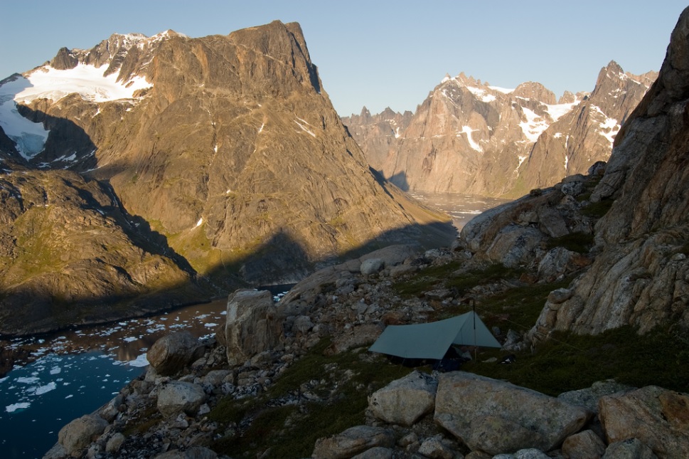
Willem's bivouac site, halfway towards the col of the Itivdlerssuaq valley (photo courtesy of Willem van Doorne)

View from the Itivdlerssuaq valley northwards, towards the 1975 'Lost Loch' camp hidden at the head of this side valley, looking towards 'Matterhorn C' (photo courtesy of Willem van Doorne)

Bivouac above the Itivdlerssuaq valley ('The Big Valley') looking eastwards towards Stordalens Havn (photo courtesy of Willem van Doorne)

View from Peak 1430 north of Itivdlerssuaq valley, looking eastwards towards Agdlerussakasit (photo courtesy of Willem van Doorne)

Willem van Doorne on summit of Peak 1430, on the north side of the Itivdlerssuaq valley (photo courtesy of Willem van Doorne)
|
PHOTOS BY TILMANN GRANER Here is a link to some pictures from Tilmann Graner's journey through 'Cape Farewell country' in 2013 with his wife Suzanne: pictures here. They travelled from Herjolfsnaes in the south, up to Tasiussaq, then along the Itivdlerssuaq valley over to Stordalens Havn. From there they hiked over the mountains in the valley north of Stordalens, and via various routes to Kangerdluk, Quinquadalen, Kangikitsoq, Tiningnertoq valley, and Tasermiut. If you click on Tilmann's larger pictures below, they take you to even larger high resolution pictures. All photos are copyright Tilmann Graner, and I am grateful for permission to reproduce them.
|

Ascending the pass north of Herjolfsnaes (photo courtesy of Tilmann Graner)

Setting off over the hills north of Herjolfsnaes, with view of mountains north of Narsarmijit (photo courtesy of Tilmann Graner)

Descending the other side of the pass north of Herjolfsnaes (photo courtesy of Tilmann Graner)

Further down the valley, on the other side of the pass from Herjolfsnaes (photo courtesy of Tilmann Graner)

View west from hill above Tasiussaq lake, Itivdlerssuaq valley is off picture to the right (photo courtesy of Tilmann Graner)

View over sea-mist from above Tasiussaq, looking towards Tasermiut (photo courtesy of Tilmann Graner)

Lake south of Nalasut - central skyline: peak 1297 which Tilmann and Suzanne ascended - Itivdlerssuaq valley is the other side of it (photo courtesy of Tilmann Graner)

On the way up Peak 1297, south of Itivdlerssuaq - in distance (center) is the fjord that leads down Igdlukasip tunua to Herjolfsnaes
in distance (right) is the channel that leads from Tasermiut south to Nanortalik - in far distance (left) are the Kitsigsut islands (photo courtesy of Tilmann Graner)

View down the Itivdlerssuaq valley to Stordalens Havn, with Angiartarfik (1845m) on the left (photo courtesy of Tilmann Graner)

Another view towards Stordalens Havn from the mountains to the south of Itivderssuaq (photo courtesy of Tilmann Graner)

View eastwards towards Agdlerussakasit (1763m) (photo courtesy of Tilmann Graner)

Teetering spires on southern skyline from Itivdlerssuaq (photo courtesy of Tilmann Graner)

View from top of Itivdlerssuaq valley, looking north towards Matterhorn C (photo courtesy of Tilmann Graner)

View eastwards from the little lake at the Itivdlerssuaq pass (photo courtesy of Tilmann Graner)

One of a chain of towers that line the south side of Itivdlerssuaq valley towards Stordalens Havn (photo courtesy of Tilmann Graner)

Huge rock face approaching Stordalens Havn (photo courtesy of Tilmann Graner)

Horses left grazing at Stordalens Havn in summer of 2013 (photo courtesy of Tilmann Graner)

Horses left grazing at Stordalens Havn in summer of 2013 (photo courtesy of Tilmann Graner)

Horse left grazing at Stordalens Havn in summer of 2013 - Pamiagdluk Island in the background (photo courtesy of Tilmann Graner)

Camp on the north side of Stordalens Havn (photo courtesy of Tilmann Graner)

Another picture of the camp on the north side of Stordalens Havn (photo courtesy of Tilmann Graner)

Looking north from Stordalens Havn (photo courtesy of Tilmann Graner)
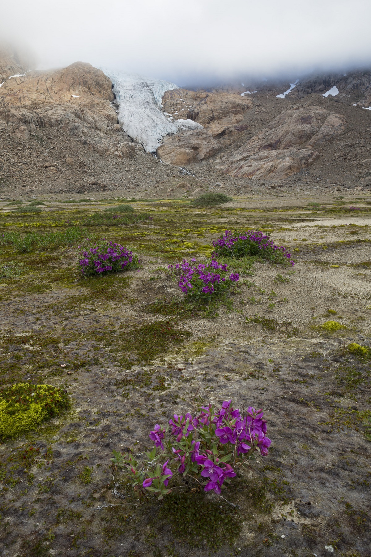
Flora in the little valley north of Stordalens Havn (photo courtesy of Tilmann Graner)

Approaching the mountain pass to the north of Stordalens Havn (photo courtesy of Tilmann Graner)

Ascending the pass north of Stordalens Havn, heading for Ivssortussut valley and Kangerdluk fjord (photo courtesy of Tilmann Graner)

View back down the mountain pass towards Stordalens Havn - Angiartarfik (1845m) in centre, with Snow Maiden to the right (photo courtesy of Tilmann Graner)

View from the pass above Stordalens towards Agdlerussakasit massif and Itivdlerssuaq valley (photo: Tilmann Graner)

East face leading to the summit of Angiartarfik (photo courtesy of Tilmann Graner)

Descending the other side of the high pass between Stordalens Havn and Ivssortussut valley (photo courtesy of Tilmann Graner)

Descending the other side of the high pass between Stordalens Havn and Ivssortussut valley (photo courtesy of Tilmann Graner)

Approaching the mountain lake in the Ivssortussut valley - Prins Christian Sund in the far distance - Kangerdluk fjord is round to the left (photo courtesy of Tilmann Graner)

Camp at the mountain lake in the Ivssortussut valley - mosquito net on! (photo courtesy of Tilmann Graner)
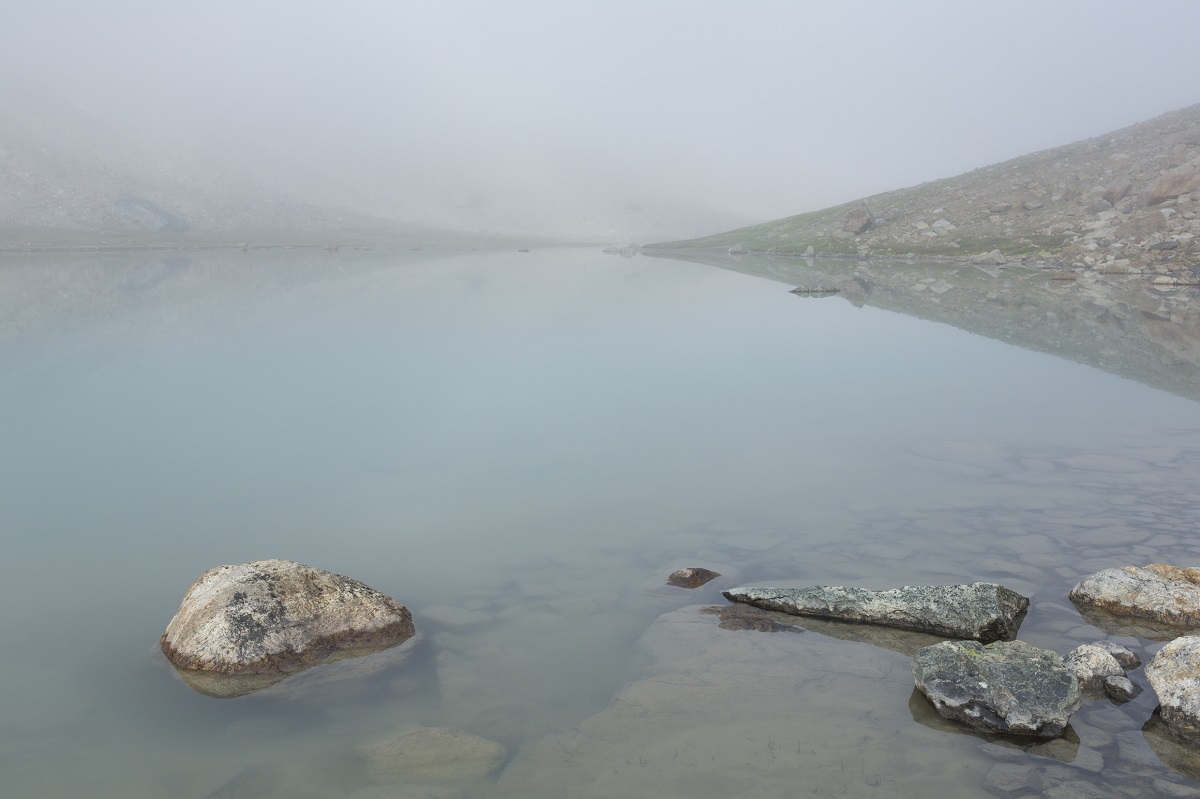
Early morning mist across the lake in Ivssortussut valley (photo courtesy of Tilmann Graner)

View back up the Ivssortussut valley (looking westwards) as the mist disperses (photo courtesy of Tilmann Graner)

View north across Kangerdluk fjord (photo courtesy of Tilmann Graner)

View south down Kangikitsoq fjord from Pk 1450 (photo courtesy of Tilmann Graner)
Summit of Pk 1450, north of Kangikitsoq (photo courtesy of Tilmann Graner)

Thick trees and willow scrub in Tiningnertoq valley,
near head of Tasermiut (photo Tilmann Graner)

Tiningnertoq valley, near the head of Tasermiut, with dwarf trees and willow scrub (photo courtesy of Tilmann Graner)
Ice-cap tumbling down the head of Tasermiut fjord (photo courtesy of Tilmann Graner)

Ice-cap tumbling down the head of Tasermiut fjord (photo courtesy of Tilmann Graner)

View of Ulamertorssuaq from camp along southern shore of Tasermiut fjord (photo courtesy of Tilmann Graner)
|
PHOTOS BY RUTH GORIS Frank Coen, Ruth Goris, Steven Lauwereins and Katleen Van Roy carried out a long hike between 11th and 27th August 2014, making crossings from Tasermiut and Quingadalen to the fjords of Kangerdluk and Kangikitsoq, and then hiked from Tasermiut to Tasiussaq lake, and through the Itivdlersuuaq valley to Stordalens Havn. They returned via Itivdlerssuaq and climbed one of the western tops (1300m) of the Putorugtoq massif.
|

Looking eastwards from Tasiussaq lake up the Itivdlerssuaq valley that leads to Stordalens Havn (photo courtesy of Ruth Goris)
Another view westwards up the Itivdlerssuaq valley (photo courtesy of Ruth Goris)

Trekking west up the Itivdlerssuaq valley towards the col (photo courtesy of expedition team)

Frank Coen, member of the Belgian team, in Itivdlerssuaq valley, 2014 (photo courtesy of Ruth Goris)

Steven Lauwereins, member of the Belgian team, in Itivdlerssuaq valley, 2014 (photo courtesy of Ruth Goris)

The fly problem! Katleen Van Roy in Itivdlerssuaq (photo courtesy of Ruth Goris)

Ruth Goris, member of the Belgian team, with view west from Itivdlerssuaq col (photo courtesy of Ruth Goris)

View north from Itivdlerssuaq col, towards the 1975 Lost Loch camp and Matterhorn C (photo courtesy of Ruth Goris)

In the Itivdlerssuaq valley, approaching Stordalens Havn (photo courtesy of Ruth Goris)

Camp at Stordalens Havn, looking across to High Rising and down the fjord toward Augpilaqtoq
(photo courtesy of expedition team)
View of the mountains south of Itivdlerssuaq, from camp at Stordalens Havn:
from left, Inevitable, Crossoak Road, Agdlerussakasit, and Ivory Tower on the right (photo courtesy of Ruth Goris)

Katleen on way up Putorugtoq, with view west down Itivdlerssuaq valley (photo courtesy of expedition team)

Final boulder field towards pyramid-shaped summit on the Putorugtoq massif, ascended in sweltering heat (photo courtesy of Ruth Goris)

Frank, Ruth, Katleen and Steven on Putorugtoq summit (photo courtesy of expedition team)

Steven on summit of Putorugtoq, looking west and south (photo courtesy of expedition team)

Steven and Frank on Putorugtoq summit, with view south over Itivdlerssuaq, towards the mountains west of Torssukatak fjord
with Whaletop and the Shepton and Breakfast Spires in the far distance, left of centre (photo courtesy of Ruth Goris)

Frank on summit of Putorugtoq, looking south. The long fjord just right of centre is skirted by viking settlements and leads to Herjolfnaes
(photo courtesy of Ruth Goris)

Katleen Van Roy on summit of Putorugtoq, with Tasermiut behind her (photo courtesy of Ruth Goris)
|
PHOTOS BY VIKTOR POSNOV In 2018 and 2019 Viktor Posnov visited South Greenland and took some great pictures of the Stordalens area and the Itivdlerssuaq valley, also visiting the Tasermiut and Quingadalen area where the 1971 St Andrews University Greenland Expedition had climbed. There is some entertaining footage of Viktor in the thick and fly-ridden undergrowth of Quingadalen here at 35:54 to 39:36. The first pictures below are imperfect quality because I have taken screenshots of relevant places filmed by Viktor's drone and recorded on the YouTube videos. But they offer some great angles and views. Finally, for anyone who wants a feel for the awesomeness of the Greenland mountains, I urge you to watch from 8:46 to 11:00 in this very evocative drone footage.
|

Stordalens Havn, looking westwards up the Itivdlerssuak valley, showing the obvious blade of Ivory Tower (first ascent July 1975) on the left (screenshot from YouTube video of drone footage, courtesy of Viktor Posnov)

Looking south down Torssukatak Fjord, showing summit of Agdlerussakasit, first ascent August 1975 (screenshot from YouTube video of drone footage, courtesy of Viktor Posnov)

View of Stordalens Havn and the long Itivdlerssuaq valley, with Angiartarfik (first ascent July 1975) towering over the harbour (screenshot from YouTube video of drone footage, courtesy of Viktor Posnov)

Viktor Posnov waving to crew members harboured at Stordalens Havn (screenshot from YouTube video of drone footage, courtesy of Viktor Posnov)

Viktor Posnov in kayak, with the great Thumbnail sea cliff of Maujit Qarqassuasia towering over Torssukatak Fjord (screenshot from YouTube video of drone footage, courtesy of Viktor Posnov)

The great Thumbnail sea cliffs of Maujit Qaqarssuasia towering over Torssukatak Fjord (screenshot from YouTube video of drone footage, courtesy of Viktor Posnov)

The view to south of the Itivdlerssuaq valley looking up to the summit of Agdlerussakasit, and the obvious blade of Ivory Tower, first climbed July 1975 (screenshot from YouTube video of drone footage, courtesy of Viktor Posnov)

View down Torssukatak Fjord from the northern end, with Pamiagdluk Island on the left, and the great Thumbnail sea cliffs of Maujit Qarqassuasia on centre (photo courtesy of Viktor Posnov)

View down Torssukatak Fjord from the northern end, with Pamiagdluk Island on the left (six peaks first ascended in 1975), and the great Thumbnail sea cliffs of Maujit Qarqassuasia on centre (photo courtesy of Viktor Posnov)

Another view down Torssukatak Fjord (photo courtesy of Viktor Posnov)

View from just west of Stordalens Havn with the Itivdlerssuaq valley leading up the right (photo courtesy of Viktor Posnov)

Agdlerussakasit towering over the Itivdlerssuaq valley (photo courtesy of Viktor Posnov)

Torssukatak Fjord leading south to the left, Agdlerussakasit summit (first ascent in August 1975) in the sunlight, and the Itivdlerssuaq valley on the right (photo courtesy of Viktor Posnov)

Wide-angle lens shot with Stordalens and the Itivdlerssuaq valley down the middle (photo courtesy of Viktor Posnov)

Wide-angle lense shot showing Pamiagdluk Island on the left, Torssukatak Fjord centre, and the Itivdlerssuaq valley leading west from Stordalens Havn, centre right (photo courtesy of Viktor Posnov)

Stordalens Havn is away to the left, with (from centre skyline) Agdlerussakasit, Ivory Tower and Ben Trilleachan (photo courtesy of Viktor Posnov)
To GreenlandExpedition.org Homepage